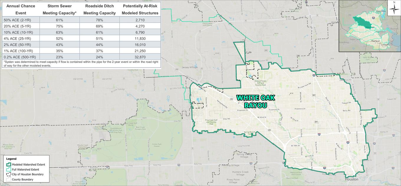

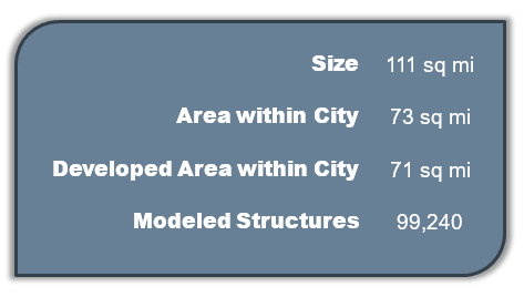
The White Oak Bayou watershed is located in the northwest portion of the City of Houston. Over 65% of the watershed is located within City limits, with other portions falling in the City of Jersey Village and unincorporated Harris County. It is bounded by Buffalo Bayou to the south and Greens Bayou to the north. Terrain in the watershed is generally flat with White Oak bayou running southeast into Buffalo Bayou. The watershed within City limits is mostly developed, consisting primarily of small-lot, single-family residences and commercial land use. The eastern portion of the watershed is predominantly medium-lot residences with sporadic parks and natural areas.
 |
 |
Modeling results indicate White Oak Bayou is generally contained within its banks for the 2-year event, with flooding starting in the 10-year event between Loop 610 and IH-10. In the 100-year event the entire bayou is overtopped causing flooding along its banks. Similarly, the other primary channels and bayous within the White Oak watershed provide 2- to 5-year system capacities with overtopping beginning in the 10-year event.
In addition to flooding resulting from inadequate system capacity of the major channels and bayous, several neighborhoods experience localized flooding from undersized storm sewer and roadside ditch. The Northside / Northline and Independence Heights areas in particular show localized flooding in less severe events unrelated to the bayou floodplains.
