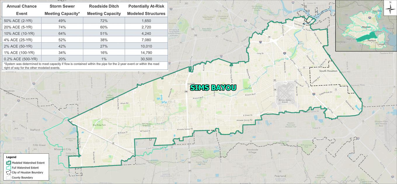

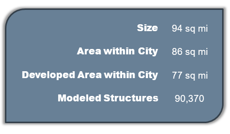
The Sims Bayou watershed is located in the southern region of the City of Houston. Most of the watershed is located within the City, with small portions falling in the cities of South Houston, Missouri City, and Stafford. It is bounded by Brays Bayou to the north and Clear Creek to the south. Terrain in the watershed is generally flat with Sims Bayou draining east into the Buffalo Bayou – Houston Ship Channel. The watershed within City limits is mostly developed, consisting primarily of small-lot, single-family residences. Pockets of commercial land can be found in the north and east portions of the watershed.
 |
 |
Modeling results indicate the Sims Bayou is generally contained within its banks through the 100-year event, with the exception of a small stretch between Hiram Clarke Drive and Almeda Road. Four major Sims Bayou tributaries contribute to street and structural flooding throughout the watershed.
Berry Bayou causes extensive flooding through backwater effects on upstream storm sewer systems. In particular, the Edgebrook area is impacted by flooding even in the 2-year event. Similarly, the Winchester area begins to see flooding in the 5-year event due to overflows and backwater effects from Channel 147-00-00. Several other pockets of flooding are seen in neighborhoods throughout the watershed (Sunnyside, Garden Villas, Oak Meadows Park, neighborhood east of Hobby Airport, and Gulf Palms) where undersized storm sewer and roadside ditch cannot alleviate flooding even for the 2- and 5-year events.
