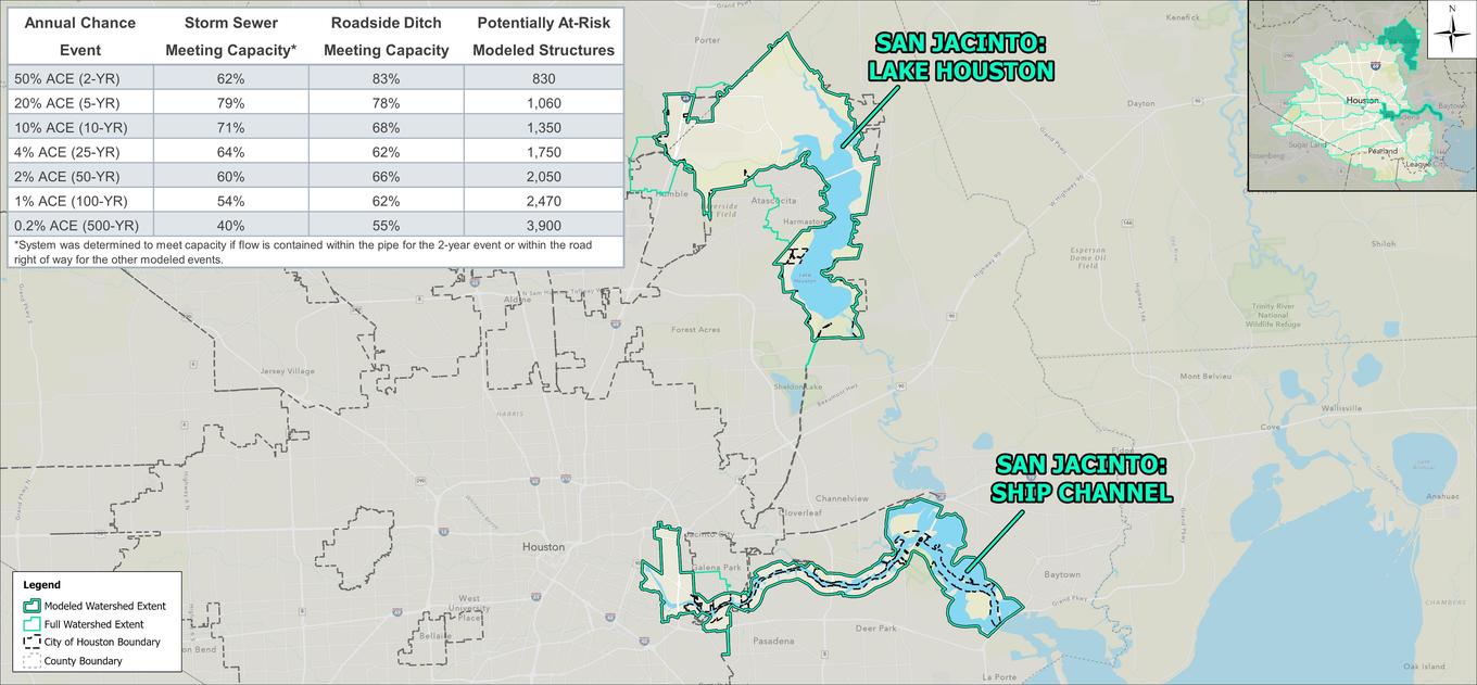


The San Jacinto watershed starts north of the City of Houston and flows around the eastern edge of the City. Most of the watershed is located outside of the City, instead falling in many counties and cities north of the Houston area. The watershed within the City was modeled as two separate components: the Kingwood area including Lake Houston, and the portion of the City within the Houston Ship Channel. The watershed has several incoming headwaters from the north, west, and south and ultimately drains to Galveston Bay. Both modeled areas largely consist of open water. The Kingwood portion of the watershed has significant residential and commercial development, while the Ship Channel has a mix of developed and undeveloped area.
 |
 |
The storm sewer in the Kingwood area performs well up to a 10-year storm event with scattered undersized pipes across the watershed. The number of pipes without capacity increases starting at the 25-year storm event and roadside ditches show a low conveyance capacity within the area. The areas within the floodplain along both the West Fork and East Fork San Jacinto Rivers are subject to riverine flooding during larger storm events as well as channel flooding along Mills Branch and Taylor Gully.
Much of the Ship Channel area drains via roadside ditch and has limited capacity especially near Clinton Drive. Storm sewers have approximately a 10-year capacity and structural flooding is noted inside of 610 near Guinevere Street. The ship channel has capacity for smaller events but tailwater does begin to affect the level of service of the local systems during larger events with some structural flooding within the floodplain.

