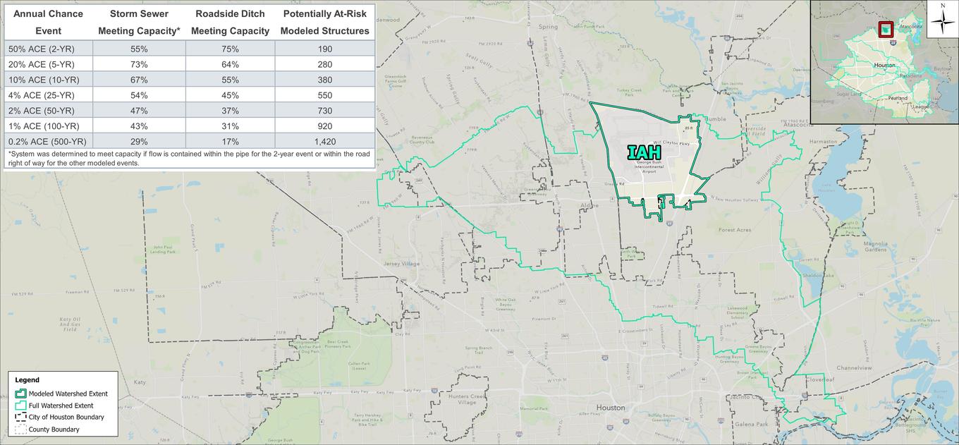

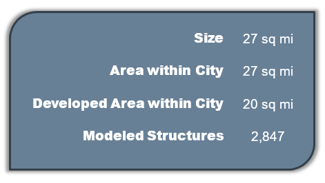
The IAH watershed is located in the northern portion of the City of Houston. The watershed characterizes drainage within the George Bush Intercontinental Airport (IAH) and the surrounding area located both within the City and within Greens Bayou. The watershed is a subset of the Greens Bayou watershed and drains to the southeast into the main Greens Bayou watershed, and ultimately the Houston Ship Channel. The watershed is almost fully developed, largely consisting of the airport itself. Adjacent areas have commercial and small-lot, single-family residential development, with small pockets of undeveloped and developed open spaces.
 |
 |
Modeling results indicate that channels in the IAH watershed start to influence flooding during the 2-year event. Reinhardt and Garners Bayou contribute to flooding in areas just south of the airport. Additionally, the tailwater effect of these bayous, and other channels in the watershed, influence connecting roadside ditch and storm sewer systems and prohibit positive drainage, impacting even more structures.
Localized flooding is also seen at many residential structures from undersized roadside ditch throughout the IAH watershed. In the airport, localized flooding is largely mitigated by the network of channels, with pockets of ponding seen around the perimeter.
