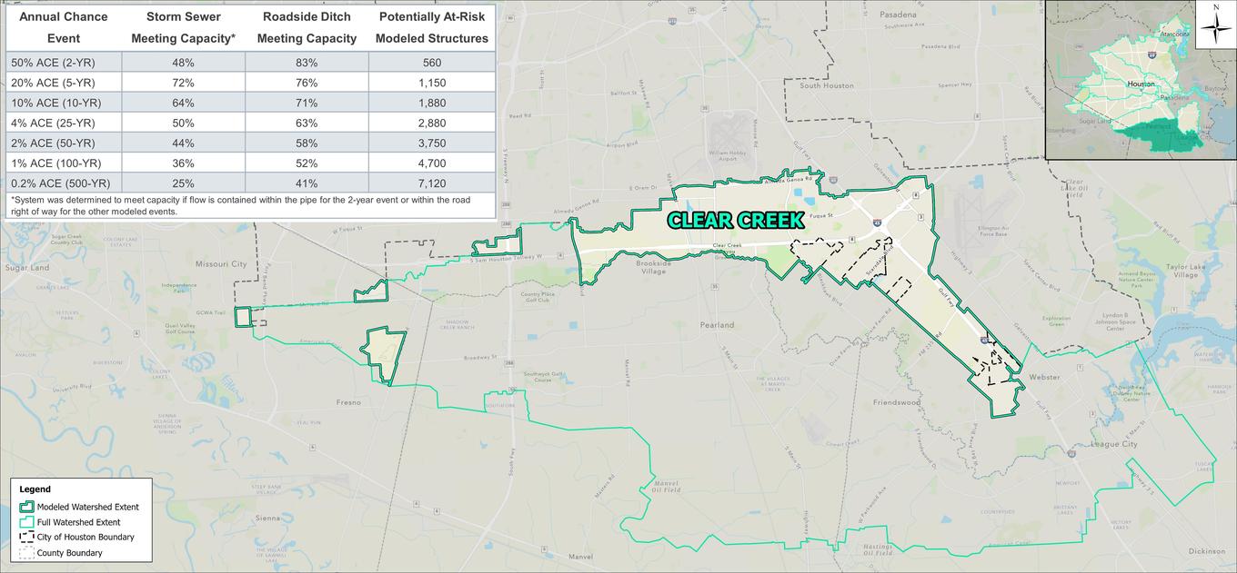


The Clear Creek watershed is located in the southern portion of the City of Houston. Over 80% of the watershed is located outside of City limits, instead falling within the cities of Pearland, Friendswood, Deer Park, and League City. It is bounded by Sims Bayou to the north and Armand Bayou to the east. Terrain in the watershed is generally flat with Clear Creek running towards the southeast. The watershed within City limits is mostly developed, consisting primarily of small-lot, single-family residences. Pockets of commercial development and open space can be found throughout the watershed.
 |
 |
Modeling results indicate that structural flooding is located primarily in the area south of the Sam Houston Tollway and west of I-45. This flood risk is likely attributed to conditions along Clear Creek itself, where the creek is unable to contain peak flows.
Beyond the flood risk associated with Clear Creek, a couple of neighborhoods were shown to experience frequent flooding due to undersized local infrastructure. Neighborhoods west of Telephone Road, bounded by Greenswarth and Catalina Lane, experience flooding starting in the 2-year event. Roadside ditches in the vicinity were shown to be undersized even for the most frequent, modeled event. Another area, near Blackhawk Park, shows structural flooding starting in the 5-year event. Storm sewer in this area primarily consists of 24-inch pipes which appear to be undersized for the service area.

