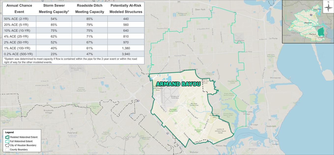

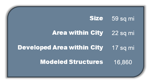
The Armand Bayou watershed is located in the southeast region of the City of Houston. Over 50% of the watershed is located outside of City limits, instead falling within the cities of Pasadena, La Porte, Deer Park, and unincorporated Harris County. It is bounded by the San Jacinto River watershed to the north, Clear Creek watershed to the east and south, and the Vince Bayou watershed to the west. Terrain in the watershed is generally flat with Armand Bayou running towards the southeast into Clear Creek. The watershed within City limits is mostly developed, consisting primarily of small-lot, single-family residences with pockets of commercial and industrial development. The area along Armand Bayou is an undeveloped nature center.
 |
 |
Modeling results indicate that structural flooding in less severe events is contained to neighborhoods in the southeastern portion of the watershed, near Cow Bayou. The bayou begins to overtop in the 10-year event and contribute to flooding of the Lyndon B. Johnson Space Center and nearby residential structures.
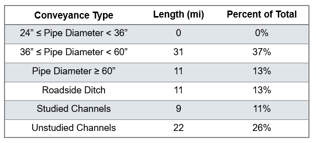
Beyond the flood risk associated with Cow Bayou, the Armand Bayou watershed does not experience significant flooding in less severe events. However, most of the watershed experiences flooding in the 100-year and 500-year events as local infrastructure, primarily roadside ditch, need more capacity for the more severe events.
